
Our research interests include hydrology, hydrodynamics, ecology, modeling, and watershed management. Our work crosses disciplinary boundaries through collaboration with a variety of departments including Law, Anthropology, Wildlife, and Forestry.
Our lab is dedicated to understanding the complex issues between hydrology and ecology with a committed interest in management issues. We work toward responsible and sustainable solutions for today’s wicked ecologic and hydrologic problems.
The Efficacy of Marsh Terraces in Enhancing and Restoring Gulf Coastal Wetlands


Problem: Marsh terracing is a coastal restoration technique implemented in the northern Gulf of Mexico to combat subsidence and sea level rise. This restoration technique has been constructed over almost 30 years; however, very little research has been conducted to determine marsh terraces optimal implementation and effectiveness.
Objective: Improve scientific understanding and practice related to marsh terrace implementation through numerical modelling informed by spatiotemporal analysis of remotely sensed and in situ field data.
Study Area: Marsh terrace fields in this study are located in the northern Gulf of Mexico within the Chenier and Deltaic Plain in coastal Louisiana. Marsh terraces are usually built in inland shallow ponds, where natural marshes have been converted to open water. Marsh terraces are segmented and discontinuous ridges of sediment built in coastal marsh areas aligned in a variety of patterns (chevron, linear, circles, etc.).
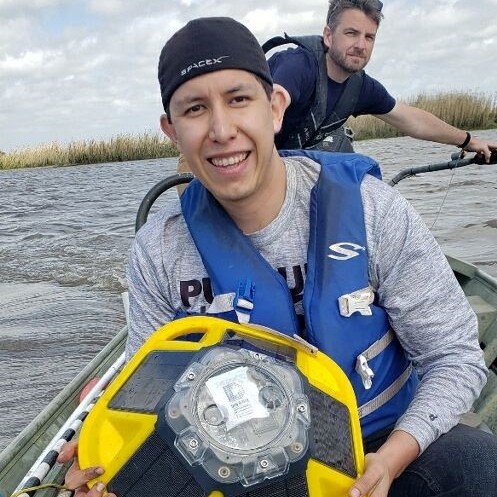
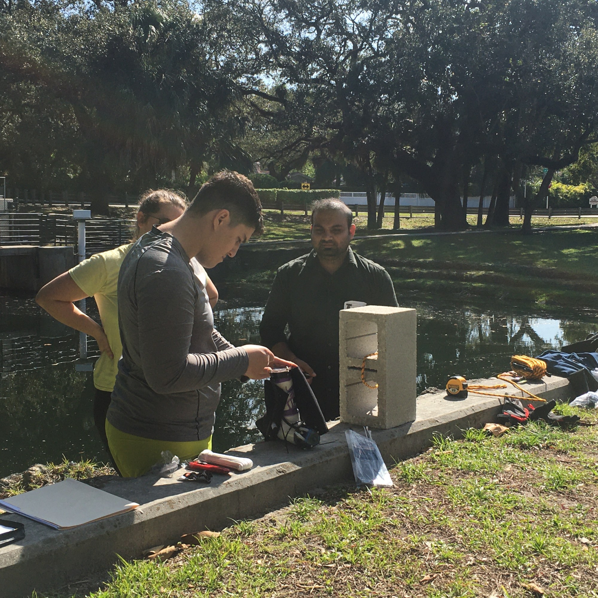
Model: The Simulating WAves Nearshore (SWAN) model simulated wind-waves at terrace fields in coastal Louisiana. Simulations were based on field conditions with and without terraces. Model input parameters included bathymetry, wind, and wave characteristics. Model validation is still ongoing using in situ measurements collected for five months at each study site by an acoustic anemometer (wind data), four acoustic doppler profilers, and a wave buoy (wave data).
Year: 2018-2020
Funding: National Academies of Sciences, Engineering and Medicine.
Using wave gages to map and assess the effect of wave climate on coastal ecosystems


Objective: An assessment of environmental and wave climate conditions suitable for coastal plants in Mississippi and gulf coast region.
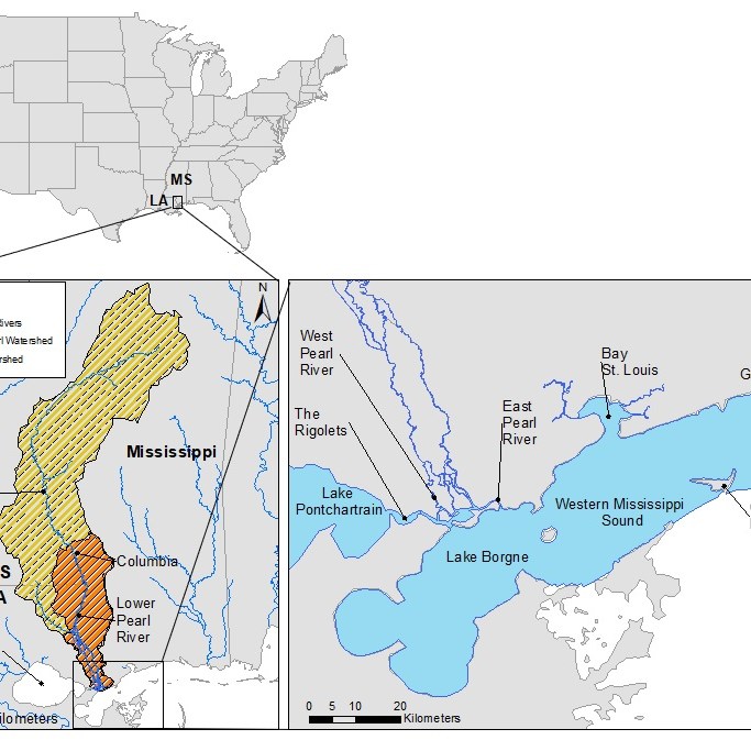
Study Area: Back Bay is located on the south of Mississippi state and north of the Gulf of Mexico where freshwater meets seawater. The incoming freshwater is the outflow of two main rivers: Hatch River and Biloxi River. This area is semi-enclosed by their lands and has an open boundary that connects to the Gulf of Mexico. The maximum depth of the bay is approximately 12 meters although most of the area has shallow water. Also, the area includes more than 6 marsh islands that are covered by vegetation and wetlands.
Model: In this study, SWAN and ADCIRC models are coupled together to simulate wave model in the non-stationary mode with unstructured mesh. Due to the complexity of the area that includes islands and different depth, an unstructured bathymetric mesh was used to simulate wave height and direction.The input data includes: wind speed, wind direction, and a bathymetric mesh. By running the models, the output results provide the spatiotemporal values of wave properties.
Year: 2019-2021
Funding: MSU MAFES SRI (Strategic Research Initiative)
Coastal water quality dynamics and modeling in Biscayne Bay, Florida


Problem: Long-term records of coastal water quality data in Biscayne Bay, Florida have shown warning signs of eutrophication across all areas of south Florida’s coastal and marine ecosystem. The National Oceanic and Atmospheric Administration (NOAA) has also designated Biscayne Bay as one of ten habitat focus areas across the country. However, the major contributing areas in upstream watersheds have not been identified.
Objective: Investigate the major sources of nutrients that contribute significantly to phytoplankton and algal blooms in Biscayne Bay, Florida.
Study Area: Biscayne Bay is a lagoon located on the Atlantic coast of South Florida, United States. Based on the water quality it has been divided into three regions: North Biscayne Bay (NBB) – watershed for this region is the most urbanized, Central Biscayne Bay (CBB) – watershed surrounding CBB region is suburban and urban, but much less dense than NBB, and South Biscayne Bay (SBB) – watershed is predominantly agricultural. SWAT model was applied to the Coral Gables watershed, which drains to the north-cental Biscayne Bay to identify the potential sources of nutrients coming from its watershed.
Model: The Soil and Water Assessment Tool (SWAT) was developed for the Coral Gables watershed, a coastal watershed that drains to the Biscayne Bay. SWAT is a physically based, spatially distributed, continuous time hydrological model. It can be used for a small watershed to a large river basin to simulate the quality and quantity of surface and ground water and predict the environmental impact of land use, land management practices, and climate change. The goal of the developed SWAT model is to identify the major nutrient contributing areas within the Coral Gables watershed that leads to phytoplankton and algal blooms in Biscayne Bay, Florida.
Year: 2019-2020
Funding: National Oceanic and Atmospheric Administration (NOAA).
Hydrodynamic and water quality modeling in the Western Mississippi Sound


Problem: The marine and estuarine ecosystems and living resources of Mississippi are of considerable importance to the area’s ecology and to the state’s economy. One of the species of this diverse ecosystem are oysters that not only act as natural filter but also their harvesting is an important source of income for the state.
Objective: To replenish and protect oyster populations in Mississippi through increasing oyster reef habitat acreage and productivity.
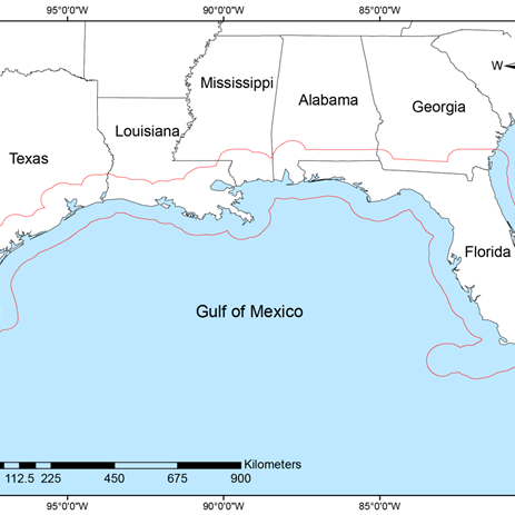
Study Area: The Western Mississippi Sound (WMSS) is bound by the coast of Mississippi to the north; the city of Gulfport, to the east; Ship Island, Cat Island, and the Biloxi Marsh to the south; and Lake Borgne (LA) to the west.
Model: In order to understand the dynamics of the environmental factors, a hydrodynamic and water quality model has been developed that simulates the circulation patterns in the WMSS under the influence of meteorological forced, tides, flows, and point source loading from the upstream.For this purpose, Visual Environmental Fluid Dynamic Code (VEFDC) was used. It solves the three dimensional, vertically hydrostatic, free surface, turbulent averaged equations of motions for a variable density fluid. Environmental envelopes include temporal and spatial state of certain environmental factors (temperature, salinity, WSE, nutrients, algae, and DO). A habitat suitability model needs to be conducted, and environmental envelopes need to be given as its input.
Funding: Mississippi State University, Mississippi Department of Environmental Quality.
Strategic conservation assessment of gulf coast landscapes

Problem: Strategic land conservation.
Objective: Identifying potential areas for land conservation using remotely sensed & GIS data, and multicriteria decision analysis.
Study Area: Gulf coast region of the United States covering coastal regions of Alabama, Florida, Louisiana, Mississippi and Texas.
Model: MCDA Model.
Tool: https://www.quest.fwrc.msstate.edu/sca-project.php
Year: 2017-2021
Funding: Department of Interior.
